
This small peninsula is surrounded by white sandy beaches along the coast and young coral reefs along the coastline. This geosite was originally an atoll landscape (coral reef island). Over time, a Tombolo was formed by the accumulation of sedimentary material that unified the islands that were originally separated, into one with the main land. The villages along the coastline are traditional fishing villages. In this area, you can also find the ruins of a dock that was used in the Dutch colonial era and remaining bunkers from the colonial era that were used as surveillance locations for ships approaching the coast at the tip of Java (picture attached).
Information of
Ujunggenteng Beach
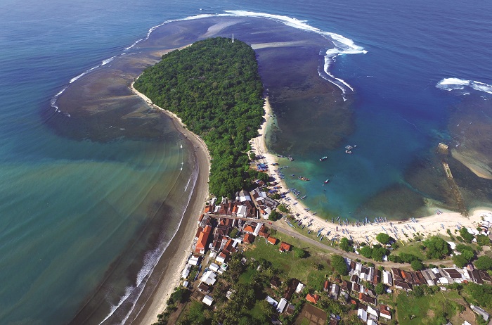
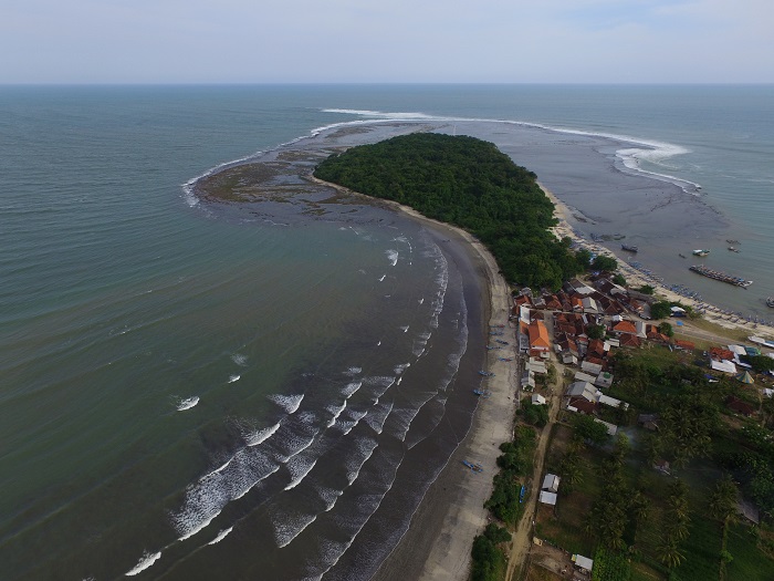
Photo Documentation
Gallery
- Empty Data